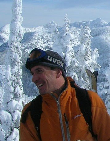
The Kootenay's are all about powder skiing.
Kootenay Skiing
The Kootenay's are all about powder skiing.

Rogers Pass

Rogers Pass is home to the big mountain powder skiing experience. The area around Rogers Pass in BC's Columbia Ranges does not require much introduction for most ski touring aficionados in North America.
Accessible by car or public transportation on the Transcanada Highway in about 4 hrs from Calgary, Rogers Pass offers some of the finest powder skiing in the world. Situated on the crest of the Selkirks the area is usually blessed with 10 meters (33 ft) of fluffy snow, which puts it on top of the record lists of snow fall in North America on a regular basis.
Imagine a vertical drop of 1700 Meters (5600ft) straight up from your car door and an affordable deluxe hotel right in the middle of it. Countless runs in the steep trees that lace the main valleys in the lower elevations and the heavily glaciated alpine terrain offer great choices every day depending on weather and snow stability.
National Park Ski Touring Information
Avalanche & Weather Information
Avalanche Forecast
Canadian Avalanche Association
Cabins
Wheeler, Asulkan, Glacier Circle available from Alpine Club of Canada.
Guidebooks
Ski Touring Rogers Pass by John Kelly
Summits and Icefields by Chic Scott
Touring at Rogers Pass Mapsheet - Murray Toft (1:50000) - Recommended
(purchase online)
Guides
Cirrrus Mountaineering
Jim Bay
On Top Mountaineering
Accommodation
Best Western at Rogers Pass
OR accomodation in Golden or Revelstoke
Retallack ( Kaslo - New Denver ) Backcountry Skiing

The deserted mining town of Retallack is the destination for ski touring between Kaslo and New Denver. Retallack cat skiing makes their home in this area skiing on both sides of the highway. There is some big terrain in this area so watch out.
Big mountains, long runs and some serious amounts of snow have earned this area a reputation as hard-core. Popular as an early season and spring time destination due to the weather and huge avalanche potential. This is not the place to go when the indicators say DANGER. Prepare yourself for a long hard day of touring and some big ascents and seldom clear weather.
Kootenay Pass - Cornice Ridge
Location: Kootenay Pass - north
Time: Full day
Difficulty: Moderate
Distance: 2km
Elevation Gain: 1800 feet
Map: 82 F/3 82 F/2
Start on the Caribou trail above the warming hut and traverse right up the ridge. Skiing back down to the lake from this point is very popular, however typically wind effected. The south-west slopes above are controlled for the highway and the north-east slope is their overshoot zone. On a good day you can see forever from the summit, and runs can be made from the ridges to the east both north and south slopes, and from the west ridge across to the Communication tower. The runs are moderately steep and steeper are require good evaluation techniques.
Time: Full day
Difficulty: Moderate
Distance: 2km
Elevation Gain: 1800 feet
Map: 82 F/3 82 F/2
Start on the Caribou trail above the warming hut and traverse right up the ridge. Skiing back down to the lake from this point is very popular, however typically wind effected. The south-west slopes above are controlled for the highway and the north-east slope is their overshoot zone. On a good day you can see forever from the summit, and runs can be made from the ridges to the east both north and south slopes, and from the west ridge across to the Communication tower. The runs are moderately steep and steeper are require good evaluation techniques.
Kootenay Pass - Ripple Ridge Cabin
Access: Kootenay Pass - South
Map Used: 82 F3 and 82 F2
Time Required: Half Day - Overnight
Kilometers: 3
Elewation Gain: 1500 ft.
Rating: Easy
Avalanche Exposure: Safe - Moderate
Park your vehicle at Kootenay Pass and cross the road south and follow the Monk Ck road past the weather station and explosives depot. The road is wide, usually well travelled and takes you right up to the pass and signs which indicate the boundary of the Provincial Park. Follow the road along level ground for about 200 metrers leaving the road when it turns left and continue along the treed ridge for another 50 meters. Touring routes start back at the pass at the edge of the Park. Tours to the east along Baldy Rocks offer lots of skiing options. Tours to the West towards Lightning Strike and ascents of Riple Mtn.
Map Used: 82 F3 and 82 F2
Time Required: Half Day - Overnight
Kilometers: 3
Elewation Gain: 1500 ft.
Rating: Easy
Avalanche Exposure: Safe - Moderate
Park your vehicle at Kootenay Pass and cross the road south and follow the Monk Ck road past the weather station and explosives depot. The road is wide, usually well travelled and takes you right up to the pass and signs which indicate the boundary of the Provincial Park. Follow the road along level ground for about 200 metrers leaving the road when it turns left and continue along the treed ridge for another 50 meters. Touring routes start back at the pass at the edge of the Park. Tours to the east along Baldy Rocks offer lots of skiing options. Tours to the West towards Lightning Strike and ascents of Riple Mtn.
Kootenay Pass - Stagleap Provincial Park Backcountry Skiing
Kootenay Pass is located between Salmo and Creston on Highway 3 just north of the U.S. border. It is the source of excellent early season powder and a wide variety of touring for all levels of skier. The pass is the highest elevation highway in British Columbia and may be closed for avalanche control at any time.
Ski Tours:
Ripple Ridge Cabin
Cornice ( or NoName ) Ridge
Baldy Rocks
Lightening Strike
Wolf Pass
Ski Tours:
Ripple Ridge Cabin
Cornice ( or NoName ) Ridge
Baldy Rocks
Lightening Strike
Wolf Pass
Plewman - Grey - Kirkup - Old Glory
Location: Red Mountain Ski Area
Map: 82 F/4
Avalanche Exposure: Moderate
Mount Grey
From the top of the Granite Chair, traverse left above the Paradise chair. At the end of traverse start down the "Long Squaw" run a couple of hundred feet looking for the Record/Grey trail on the left. Leave the ski area heading North, looking for the low point between Granite and Record. Continue through the small pass gently traversing right and climbing slightly over one kilometer. From the summit of Grey Mountain south facing runs can be made easily, skinning back up or back to ski area on trail.
Mount Kirkup
Proceed as for Grey mountain from the top of the Granite chair. From the top of Grey mountain continue skiing north, easily gaining ridge and following east to the summit of Kirkup. From the top there are moderate treed slopes to the north down to the Highway, tend to the right to avoid tight trees. Alternatively the East Chute (avalanche hazard) down to the Highway tending left to avoid tight trees.
Mount Plewman
Follow the Hanna Creek Road on the south side of the highway to the start of Unnecessary ridge, about one hour. Follow the ridge northwest to a small sub peak at the head of Esling creek. Many people skip the unnecessary part and take the direct line on the Old Glory Trail from 500m up the road. Continue north and east along ridge to the summit of Plewman. Numerous descents possible from the open alpine bowls at the top. Be sure to traverse back into the Old Glory trail before the trees get thick. Some people also tour to Plewman from 6km further up the highway following ridges with good skiing.
Old Glory
Old Glory
Time: Full day/Onight
Difficulty: Moderate to High
Distance: Kilometers: 20
Elevation_Gain: 3200 feet
Avalanche Exposure: Moderate/High
Follow the Hanna Creek Road on the south side of the highway to the start of Unnecessary ridge, about one hour. Follow the ridge northwest to a small sub peak at the head of Esling creek. From here drop slightly to the south west and gain the main South ridge of Old Glory. Follow the ridge steeply to the summit and descend by the ascent route. There are many good possibilities for tent camping sights.
Map: 82 F/4
Avalanche Exposure: Moderate
Mount Grey
From the top of the Granite Chair, traverse left above the Paradise chair. At the end of traverse start down the "Long Squaw" run a couple of hundred feet looking for the Record/Grey trail on the left. Leave the ski area heading North, looking for the low point between Granite and Record. Continue through the small pass gently traversing right and climbing slightly over one kilometer. From the summit of Grey Mountain south facing runs can be made easily, skinning back up or back to ski area on trail.
Mount Kirkup
Proceed as for Grey mountain from the top of the Granite chair. From the top of Grey mountain continue skiing north, easily gaining ridge and following east to the summit of Kirkup. From the top there are moderate treed slopes to the north down to the Highway, tend to the right to avoid tight trees. Alternatively the East Chute (avalanche hazard) down to the Highway tending left to avoid tight trees.
Mount Plewman
Follow the Hanna Creek Road on the south side of the highway to the start of Unnecessary ridge, about one hour. Follow the ridge northwest to a small sub peak at the head of Esling creek. Many people skip the unnecessary part and take the direct line on the Old Glory Trail from 500m up the road. Continue north and east along ridge to the summit of Plewman. Numerous descents possible from the open alpine bowls at the top. Be sure to traverse back into the Old Glory trail before the trees get thick. Some people also tour to Plewman from 6km further up the highway following ridges with good skiing.
Old Glory
Old Glory
Time: Full day/Onight
Difficulty: Moderate to High
Distance: Kilometers: 20
Elevation_Gain: 3200 feet
Avalanche Exposure: Moderate/High
Follow the Hanna Creek Road on the south side of the highway to the start of Unnecessary ridge, about one hour. Follow the ridge northwest to a small sub peak at the head of Esling creek. From here drop slightly to the south west and gain the main South ridge of Old Glory. Follow the ridge steeply to the summit and descend by the ascent route. There are many good possibilities for tent camping sights.
Rossland - Record Ridge Backcountry Skiing
Location: Red Mtn Ski Area. Granite Chair
Time: Half Day
Difficulty: Easy
Distance: 4
Elevation_Gain: 600 or 2000 feet
Map: 82 F/4
Avalanche: Moderate/High: check Ski Patrol
From the top of the Granite Chair, traverse above the Paradise chair. Follow the ski trail into the pass where "Silver Sheep" and "Long Squaw" fork. Leave the ski area, descend into gully, and gain ridge to west, proceeding along Record Mountain. The easier runs are at the start and allow easy access back to the Paradise chair. Many people have been caught in avalanches on the North Face and gullies along ridge. The longer steeper runs are further south and require skinning back up the creek bottom, or leaving a vehicle along the old "Cascade Highway". Many people tour up from the highway avoiding the ski hill entirely.
Time: Half Day
Difficulty: Easy
Distance: 4
Elevation_Gain: 600 or 2000 feet
Map: 82 F/4
Avalanche: Moderate/High: check Ski Patrol
From the top of the Granite Chair, traverse above the Paradise chair. Follow the ski trail into the pass where "Silver Sheep" and "Long Squaw" fork. Leave the ski area, descend into gully, and gain ridge to west, proceeding along Record Mountain. The easier runs are at the start and allow easy access back to the Paradise chair. Many people have been caught in avalanches on the North Face and gullies along ridge. The longer steeper runs are further south and require skinning back up the creek bottom, or leaving a vehicle along the old "Cascade Highway". Many people tour up from the highway avoiding the ski hill entirely.
Rossland Backcountry Skiing
Rossland is the Kootenay's true alpine village. The streets are snow covered and empty during the day as the town empties to enjoy the delights of Red Mountain which rises directly above the town. ong known as a skiers town with steep tree runs, secret runs, easy touring out of the ski hill and a bizarre collection of skiers. Whitewater and Red skiers always compete for who had the best snow last year - but the truth is that you had to be there skiing to really know...
Rossland Ski Touring Destinations:
Record Ridge
Plewman - Grey - Kirkup
Roberts
Old Glory
Rossland Ski Touring Destinations:
Record Ridge
Plewman - Grey - Kirkup
Roberts
Old Glory
Whitewater - Blaster's Ridge Backcountry
Location: Whitewater Ski Area. Purchase a single ridge ticket and ride the Summit Chair.
Time: Half day
Difficulty: Moderate
Distance: Short
Elevation_Gain: 200 meters
Map: 82 F/6
Avalanche Exposure: Moderate
From the top of the Summit Chair ski left along the run on the top of the ridge. Stop at the top of Motherlode and look for the Ski Patrol Warning Sign in the little dip before the traverse. The route stays closely on the ridge and is used by the Ski Patrol as a safe route to the top of their blasting run during high avalanche conditions. After numerous tight switchbacks the top of the ridge is gained. A steep tree glade named "Garbage Chutes" is an exciting descent next to the route of ascent. There are a series of progressively steeper lines ( N facing ) that continue for the next kilometer along this ridge. The trip out to Sherpa Valley takes the flat ridge to the South with cliffs lining the right hand side. After five hundred meters you will break into a small bowl, known as Sherpa Valley.
Time: Half day
Difficulty: Moderate
Distance: Short
Elevation_Gain: 200 meters
Map: 82 F/6
Avalanche Exposure: Moderate
From the top of the Summit Chair ski left along the run on the top of the ridge. Stop at the top of Motherlode and look for the Ski Patrol Warning Sign in the little dip before the traverse. The route stays closely on the ridge and is used by the Ski Patrol as a safe route to the top of their blasting run during high avalanche conditions. After numerous tight switchbacks the top of the ridge is gained. A steep tree glade named "Garbage Chutes" is an exciting descent next to the route of ascent. There are a series of progressively steeper lines ( N facing ) that continue for the next kilometer along this ridge. The trip out to Sherpa Valley takes the flat ridge to the South with cliffs lining the right hand side. After five hundred meters you will break into a small bowl, known as Sherpa Valley.
Whitewater - Evening Ridge Backcountry Skiing

Location: 2 Km before Whitewater Ski Area at KM 10.5 Parking Area.
Time: Half/Full Day
Difficulty: Easy - Moderate
Distance: 5 km
Elevation Gain: 1700 feet
Map: 82 F/6
Avalanche Exposure: Low - Moderate
Park your vehicle in a small turnout at the big bend about 8 kilometers on the Whitewater Ski Area road. FInd the logging road that heads down to Apex creek in an upstream direction. Whitewater has created cross country ski trails in this region and so the ski touring access is a matter of following the trails into the drainage. Easiest to take the right hand side of the creek and take the ridge on the right of the creek and when the road crosses the creek again leave the road and follow the creek directly up through Hummingbird Pass. To access Evening Ridge continue all the way through the pass, just before descending, traverse back left, quickly ascending through open trees to gain the ridge above the Pass. Continue up the ridge as far as you desire, with beautiful views of Ymir Peak and the Kokanne Group. The descent route is either down the ascent route, or down various lines on the East face. There are several major avalanche slopes and very steep avalanche prone slopes on this face, and require skill and very good stability assessment.
Time: Half/Full Day
Difficulty: Easy - Moderate
Distance: 5 km
Elevation Gain: 1700 feet
Map: 82 F/6
Avalanche Exposure: Low - Moderate
Park your vehicle in a small turnout at the big bend about 8 kilometers on the Whitewater Ski Area road. FInd the logging road that heads down to Apex creek in an upstream direction. Whitewater has created cross country ski trails in this region and so the ski touring access is a matter of following the trails into the drainage. Easiest to take the right hand side of the creek and take the ridge on the right of the creek and when the road crosses the creek again leave the road and follow the creek directly up through Hummingbird Pass. To access Evening Ridge continue all the way through the pass, just before descending, traverse back left, quickly ascending through open trees to gain the ridge above the Pass. Continue up the ridge as far as you desire, with beautiful views of Ymir Peak and the Kokanne Group. The descent route is either down the ascent route, or down various lines on the East face. There are several major avalanche slopes and very steep avalanche prone slopes on this face, and require skill and very good stability assessment.
White Queen - Five Mile Backcountry Skiing
 Location: Whitewater Ski Area. Skin to the top of Yankee Girl.
Time: Half Day
Difficulty: Easy
Distance: 3 km
Elevation Gain: 1500 feet
Map: 82 F/6
Avalanche Exposure: Moderate
From the top of the Yankee Girl ski run proceed outside the Ski Area, zigzagging directly upwards to gain the pass ( 15-20 minutes ). The ridge is narrow and offers spectacular views into Five Mile and of Ymir Peak. From here steep descents can be made into Five Mile Basin. To go to White Queen summit turn away from Ymir Peak and head NW ( left ) along the ridge. To climb to the summit of Half Dome climb the ridge ( right ) for awesome runs of around 1500 ft.
The far side of Five Mile Bowl offers a further set of adventures with steep climbing, steep skiing and perfect north-west facing powder.
The best way out of Five Mile is by climbing and traversing down the valley through the trees and gaining the White Queen Ridge. Great runs from here on steep West facing slopes down to the Ski Area Access Road.
Other Tours at Whitewater:
Evening Ridge
Ymir Peak
Ymir Peak Backcountry Skiing
 Location: Whitewater Ski Area
Time: Half day - Full Day
Difficulty: Moderate
Distance: 3km
Elevation Gain: 1500 feet
Map: 82 F/6
Avalanche Exposure: Moderate/High
A number of options are available to gain access to Ymir Bowl and Ymir Peak. The ridge line from Blasters ridge to the summit is the longest route but the most scenic and safest. Alternatively from the White Queen Pass climbing up the ridge and traversing high under the rocks over steep terrain and gaining the ridge. The ridgetop is called Half Dome and good runs can be made form here into Five Mile. From just below the final climb to Half Dome a traverse can be made into Ymir bowl. Ymir Bowl is not a good place to be unless Avalanche conditions are very stable. Once in the bowl Kututle Pass is an interesting destination or Ymir Peak can be gained from the bench just to the left of the Peak. The route to and from the Peak involves careful maneouvering on rocks and snow on the steep East slopes of Ymir Peak.
From lookers left to right
Five Mile Saddle above the lift, Goat's Slide, Half Dome, Scob's Knob ( the treed knob within the bowl ), Kututle Notch, Cookie Cliffs, Chute, Ymir Peak, Dogs Leg, First Choice, West Ymir, and Prospector's Bowl at the edge of the ski area.
Whitewater - Evening Ridge Backcountry Skiing
 Location: 2 Km before Whitewater Ski Area at KM 10.5 Parking Area.
Time: Half/Full Day
Difficulty: Easy - Moderate
Distance: 5 km
Elevation Gain: 1700 feet
Map: 82 F/6
Avalanche Exposure: Low - Moderate
Park your vehicle in a small turnout at the big bend about 8 kilometers on the Whitewater Ski Area road. FInd the logging road that heads down to Apex creek in an upstream direction. Whitewater has created cross country ski trails in this region and so the ski touring access is a matter of following the trails into the drainage. Easiest to take the right hand side of the creek and take the ridge on the right of the creek and when the road crosses the creek again leave the road and follow the creek directly up through Hummingbird Pass. To access Evening Ridge continue all the way through the pass, just before descending, traverse back left, quickly ascending through open trees to gain the ridge above the Pass. Continue up the ridge as far as you desire, with beautiful views of Ymir Peak and the Kokanne Group. The descent route is either down the ascent route, or down various lines on the East face. There are several major avalanche slopes and very steep avalanche prone slopes on this face, and require skill and very good stability assessment.
Whitewater Backcountry Ski Guidebook
 Whitewater is known as the powder hideaway of the Kootenays. The Ski Area itself is partly a ski touring experience with long traverses seeking untrampled powder part of the skiers day. The surrounding bowls and ridges offer a huge expanse of technical ski touring and the high elevation offers a deep powder experience long after the last snowfall. The ski touring is through extremely steep terrain and many of the classic runs are obviously very susceptible to unstable conditions - the avalanche torn trees only begin to tell the story....
Backcountry Ski Tours:
Blaster's Ridge Sidecountry
Evening Ridge
Ymir Peak ( Ymir Bowl and chutes )
White Queen / Five Mile Basin
Kootenay Backcountry Ski Guidebook

The Kootenays offer some of the best backcountry powder skiing. A huge amount of wilderness terrain with cool but not cold temparture and generally little wind allows the snow to fall deep and soft. Here's a few trips to whet your appetite. The Guides and Backcountry Hut Operators have a few more adventures to challenge you.
Bonnington Range ( Nelson )
Fernie
Purcells ( Golden - Invermere )
Kokanee Range
Rogers Pass ( Golden - Revelstoke )
Retallack ( Kaslo - New Denver )
Kootenay National Park
Kootenay Pass / Stagleap Provincial Park ( Creston - Salmo )
Red Mountain ( Rossland )
Whitewater ( Nelson )
Valhalla Range
Yoho Provincial Park
Multi Day Ski Tours
Kootenay Ski Touring
 The peace, tranquillity and utter wildness that the winter can bring to the mountaintops is pure magic. Floating through a severe Kootenay powder run is an experience that you will never forget. Only a few times in our lives do we transcend the World so completely - more so for Kootenay residents and even more the powder ski freaks.
The best powder runs are experienced after you have worked hard every step, for every turn and NO ONE has laid a track near yours all winter. At the end of your day you can look back at your slope, remembering, savouring, and knowing that the next storm will wipe the slope clean. Ski Touring is the ultimate environmentally friendly way of travelling - you leave nothing not even footprints, just taking memories. The Kootenays are blessed with some of the best ski touring in the world. Please respect this miracle with every step and every turn.
The Kootenays are home to most of the backcountry ski lodges in British Columbia. Some of the best roadside ski touring is available in the Kootenays: Kootenay Pass and Rogers Pass.
Ski Touring Links
FreeHeels - Nils Larsen
Off Piste Journal
Kootenay Backcountry Skiing Lodges
Lodges in the Kootenays
Ymir Yurts, Nelson, BC
Mistaya Lodge, Golden BC
Powder Creek Lodge, Nelson BC
Purcell Lodge, Golden, BC
Ptarmigan Tours, Kimberley, BC
Sorcerer Lodge, Golden, BC
Valhalla Mountain Touring, New Denver
Kootenay Mountain Huts, Kaslo, BC
Backcountry Lodges of British Columbia
Association - link to all member huts
Lodges in Canada
Canadian Alpine Club Huts:
Abbot Pass Hut, Rockies
Balfour Hut, Rockies
Bow Hut, Rockies
Colgan Hut, Rockies
Scott Duncan Hut, Rockies
Fairy Meadow Hut, Selkirks
Fay Hut, Rockies
Fryatt Hut, Rockies
Grassi Hut, Rockies
Great Cairn Hut, Selkirks
Stanley Mitchell Hut, Rockies
Elizabeth Parker Hut, Rockies
Peyto Hut, Rockies
Wates-Gibson Hut, Rockies
A. O. Wheeler Hut, Selkirks
Glacier National Park -- near Rodgers Pass in the Selkirk Mtns.
Asulkan Cabin
Glacier Circle Cabin
Saphire Col
Ymir Yurts, Nelson, BC
Mistaya Lodge, Golden BC
Powder Creek Lodge, Nelson BC
Purcell Lodge, Golden, BC
Ptarmigan Tours, Kimberley, BC
Sorcerer Lodge, Golden, BC
Valhalla Mountain Touring, New Denver
Kootenay Mountain Huts, Kaslo, BC
Backcountry Lodges of British Columbia
Association - link to all member huts
Lodges in Canada
Canadian Alpine Club Huts:
Abbot Pass Hut, Rockies
Balfour Hut, Rockies
Bow Hut, Rockies
Colgan Hut, Rockies
Scott Duncan Hut, Rockies
Fairy Meadow Hut, Selkirks
Fay Hut, Rockies
Fryatt Hut, Rockies
Grassi Hut, Rockies
Great Cairn Hut, Selkirks
Stanley Mitchell Hut, Rockies
Elizabeth Parker Hut, Rockies
Peyto Hut, Rockies
Wates-Gibson Hut, Rockies
A. O. Wheeler Hut, Selkirks
Glacier National Park -- near Rodgers Pass in the Selkirk Mtns.
Asulkan Cabin
Glacier Circle Cabin
Saphire Col
Kootenay Snowcat Skiing
The Kootenays are home to some of the finest backcountry powder skiing in the world. The Selkrik mountains of British Columbia contain more snowcat and helicopter skiing operations than anywhere in the world. This is the place to come for the ultimate powder skiing experience.
Wildhorse CatSkiing Powder Mining Co. - Nelson
Selkirk Wilderness Skiing - Meadow Creek
Retallack - Kaslo/New Denver
White Grizzly- Meadow Creek
Baldface Lodge- Nelson
Valhalla PowderCats - Slocan Valley
Island Lake Lodge - Fernie
Operators in British Columbia
Catskiing.ca
Powder Magazine Heli & Snowcat Guide
Wildhorse CatSkiing Powder Mining Co. - Nelson
Selkirk Wilderness Skiing - Meadow Creek
Retallack - Kaslo/New Denver
White Grizzly- Meadow Creek
Baldface Lodge- Nelson
Valhalla PowderCats - Slocan Valley
Island Lake Lodge - Fernie
Operators in British Columbia
Catskiing.ca
Powder Magazine Heli & Snowcat Guide
Kootenay Helicopter Skiing
The Kootenays are home to some of the finest backcountry powder skiing in the world. The Selkrik mountains of British Columbia contain more snowcat and helicopter skiing operations than anywhere in the world. This is the place to come for the ultimate powder skiing experience.
CMH Kootenay
CMH Galena
CMH Bugaboo
Subscribe to:
Posts (Atom)